Library of Congress
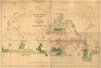
Matthew Maury, an American Naval officer used data from various sources, including logbooks and whaling ships to create this map showing the distribution of several species of whales. This color lithograph, published in 1851, was an innovative, thematic map at the time. It documents the importance of the mid-19th century whaling industry.
JavaScript required access all features of this site. Use Browser Back to return.