Martha's Vineyard Museum
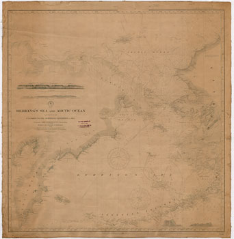
This navigation chart of the Behring's Sea and Arctic Ocean was created from the surveys of the U.S. North Pacific Surveying Expedition in 1855, and from Russian and English Authorities. Additions and corrections were added in 1889. It includes a stamp noting additional corrections were made in 1894.
JavaScript required access all features of this site. Use Browser Back to return.