Martha's Vineyard Museum
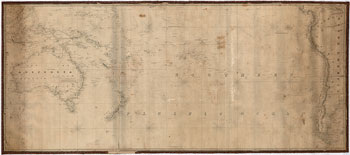
This navigation chart covers the Eastern shores of Asia to the Western coast of North America, and from the Equator to the Behring's Strait. It was published by James Imray, Chart and Nautical Bookseller, in 1894.
JavaScript required access all features of this site. Use Browser Back to return.